Geolocation
Graylog lets you extract and visualize geolocation information from IP addresses in your logs. Here we will explain how to install and configure the geolocation resolution, and how to create a map with the extracted geo-information.
Setup
The Graylog Map Widget is the plugin providing geolocation capabilities to Graylog. The plugin is compatible with Graylog 2.0.0 and higher, and it is installed by default, although some configuration is still required on your side. This section explains how to configure the plugin in detail.
In case you need to reinstall the plugin for some reason, you can find it inside the Graylog tarball in our downloads page. Follow the instructions in Installing and loading plugins to install it.
Configure the database
In first place, you need to download a geolocation database. We currently support MaxMind City databases in the MaxMind DB format, as the GeoIP2 City Database or GeoLite2 City Database that MaxMind provides.
The next step is to store the geolocation database in all servers running Graylog. As an example, if you
were using the Graylog OVA, you could save the database in the /var/opt/graylog/data folder, along
with other data used by Graylog. Make sure you grant the right permissions so the user running Graylog
can read the file.
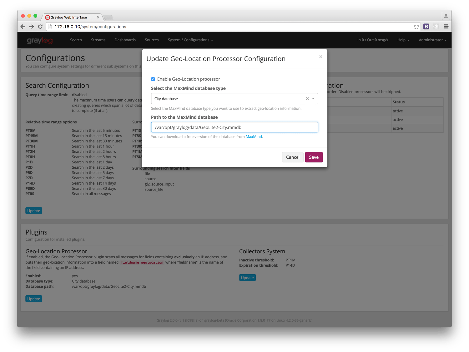
Then you need to configure Graylog to start using the geolocation database to resolve IPs in your logs. To do that, open Graylog web interface in your favourite browser, and go to System -> Configurations. You can find the geolocation configuration under the Plugins / Geo-Location Processor section, as seen in the screenshot.
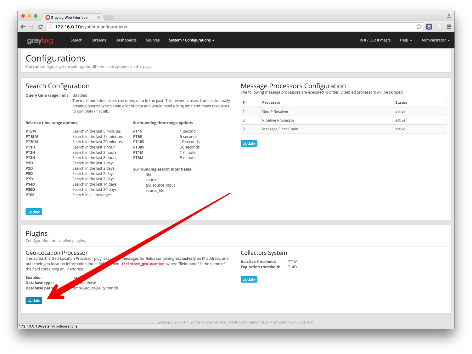
In the configuration modal, you need to check the Enable geolocation processor, and enter the path to the geolocation database you use. Once you are all set, click on save to store the configuration changes.
Configure the message processor
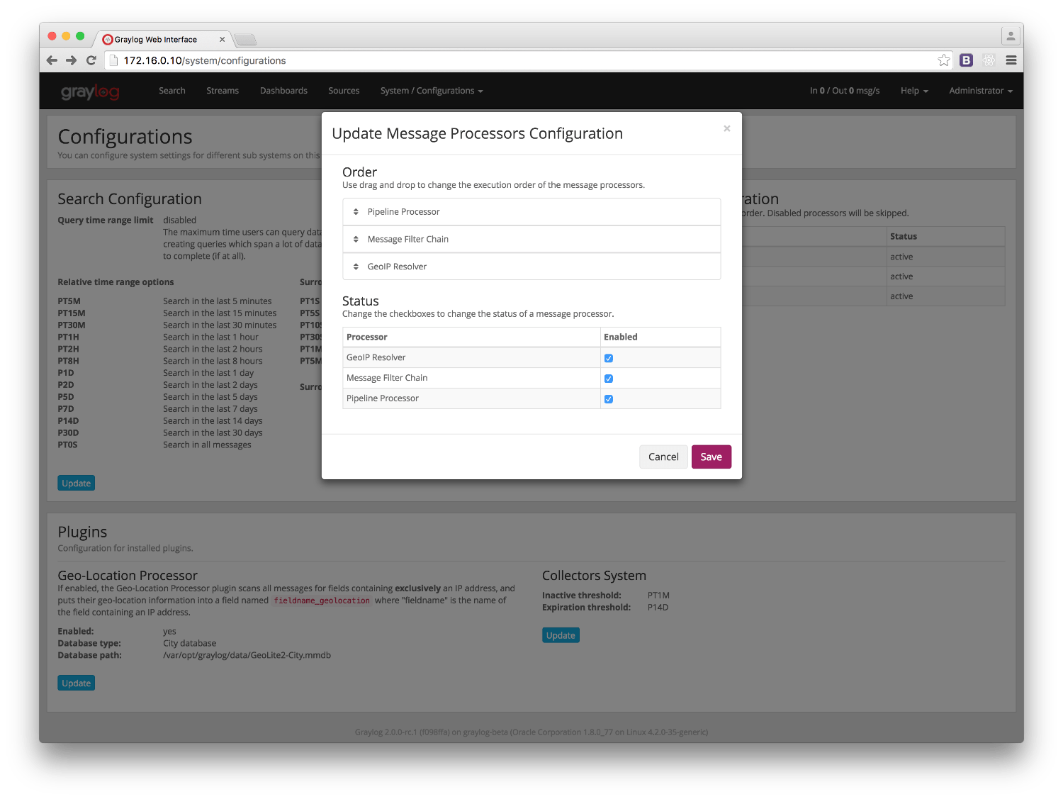
The last step before being able to resolve locations from IPs in your logs, is to activate the GeoIP Resolver processor. In the same System -> Configurations page, update the configuration in the Message Processors Configuration section.
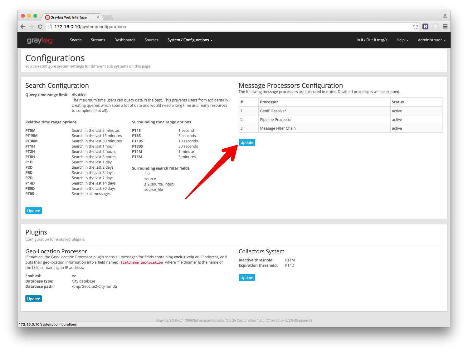
In that screen, you need to enable the GeoIP Resolver, and you must also set the GeoIP Resolver as the last message processor to run, if you want to be able to resolve geolocation from fields coming from extractors.
That’s it, at this point Graylog will start looking for fields containing exclusively an IPv4 or IPv6
address, and extracting their geolocation into a <field>_geolocation field.
注解
In case you are not sending structured logs to Graylog, you can use extractors to store the IP addresses in your messages into their own fields. Check out the Extractors documentation for more information.
重要
The GeoIP Resolver processor will not process any internal message fields, i. e. any field starting with gl2_ such as gl2_remote_ip.
Verify the geolocation configuration (Optional)
To ensure the geolocation resolution is working as expected, you can do the following:
- Create a TCP Raw/Plaintext input:
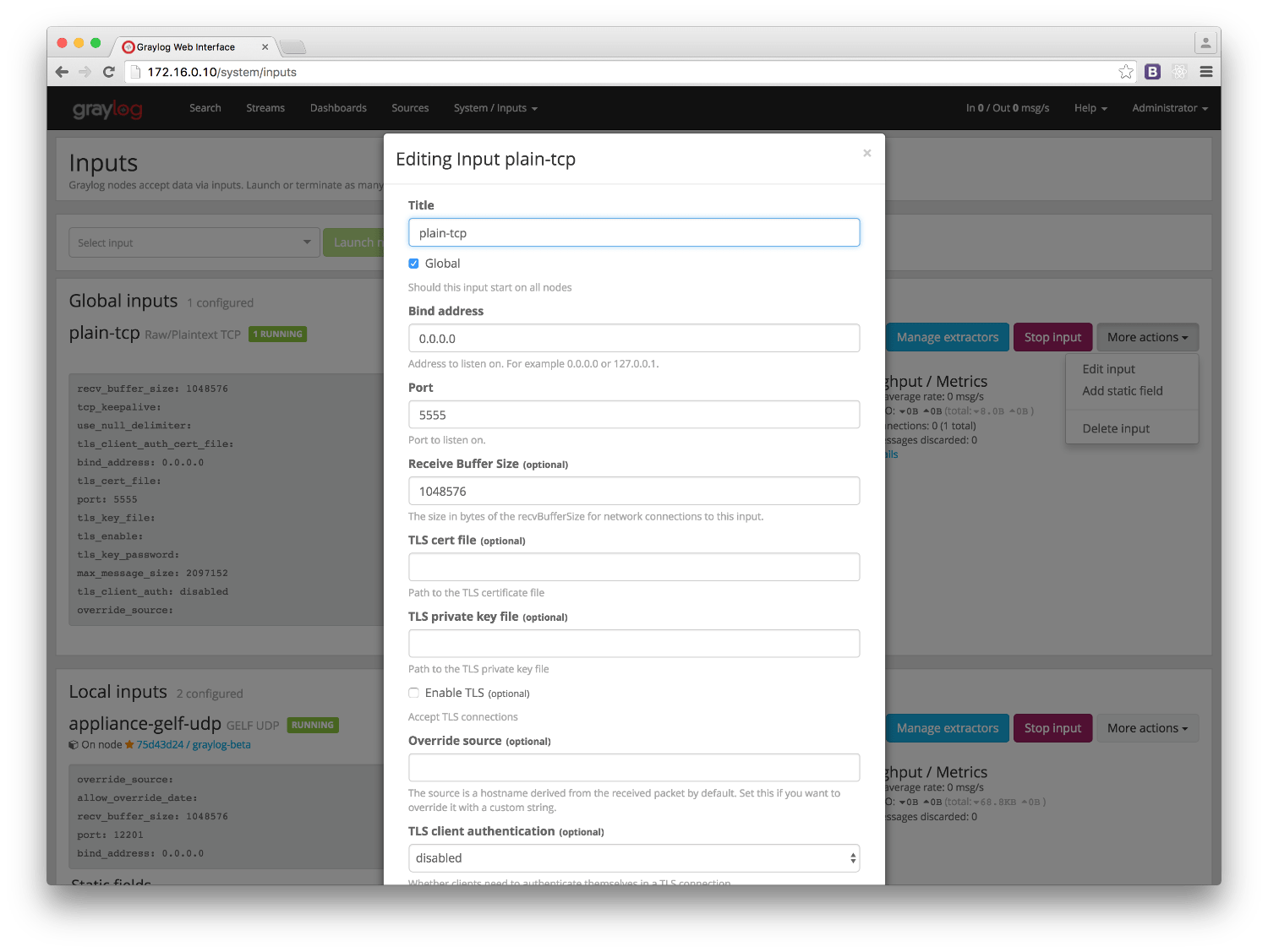
2. Send a message only containing an IP to the newly created input. As an example, we will be using the nc command:
nc -w0 <graylog_host> 5555 <<< '8.8.8.8'
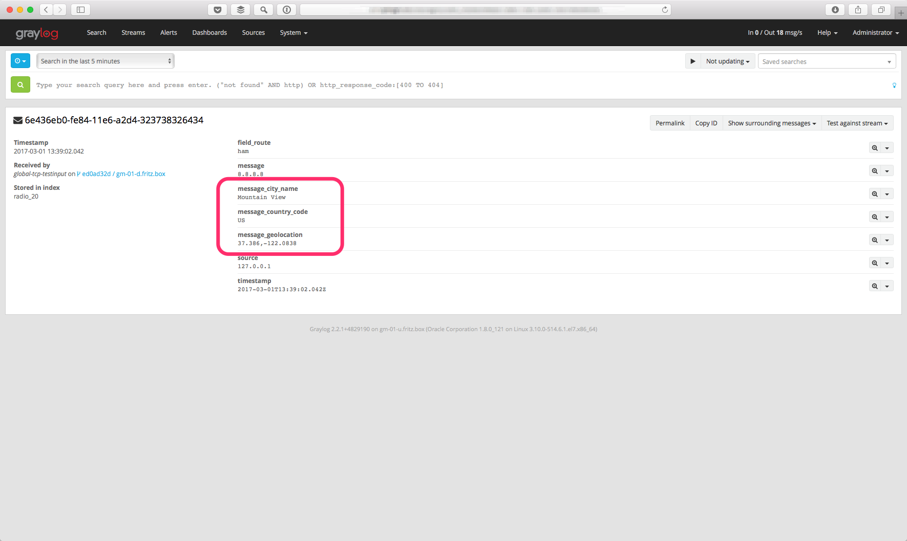
- Verify that the message contains a
message_geolocationfield:
- Delete the input if you don’t need it any more
In case the message does not contain a message_geolocation field, please check your Graylog server logs, and
ensure you followed the steps in the Configure the database section.
Visualize geolocations in a map
Graylog can display maps from geolocation stored in any field, as long as the geo-points are using the
latitude,longitude format.
Display a map in the search results page
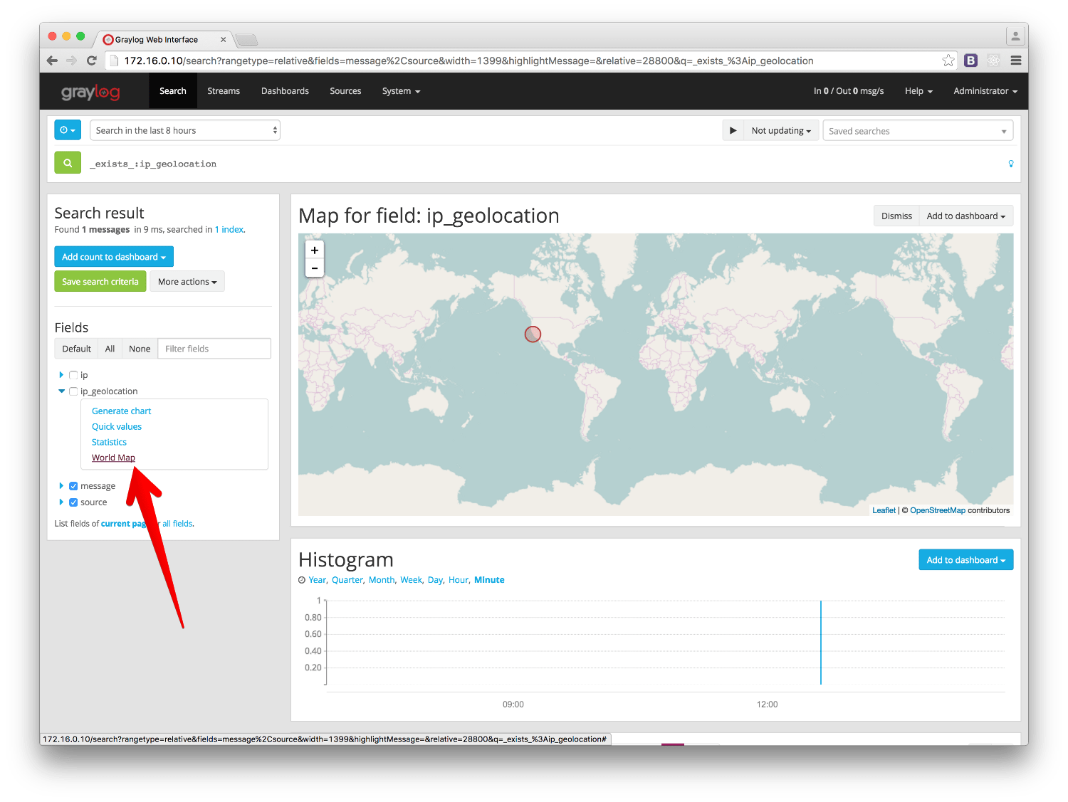
On any search result page, you can expand the field you want to use to draw a map in the search sidebar, and click on the World Map link. That will show a map with all different points stored in that field.
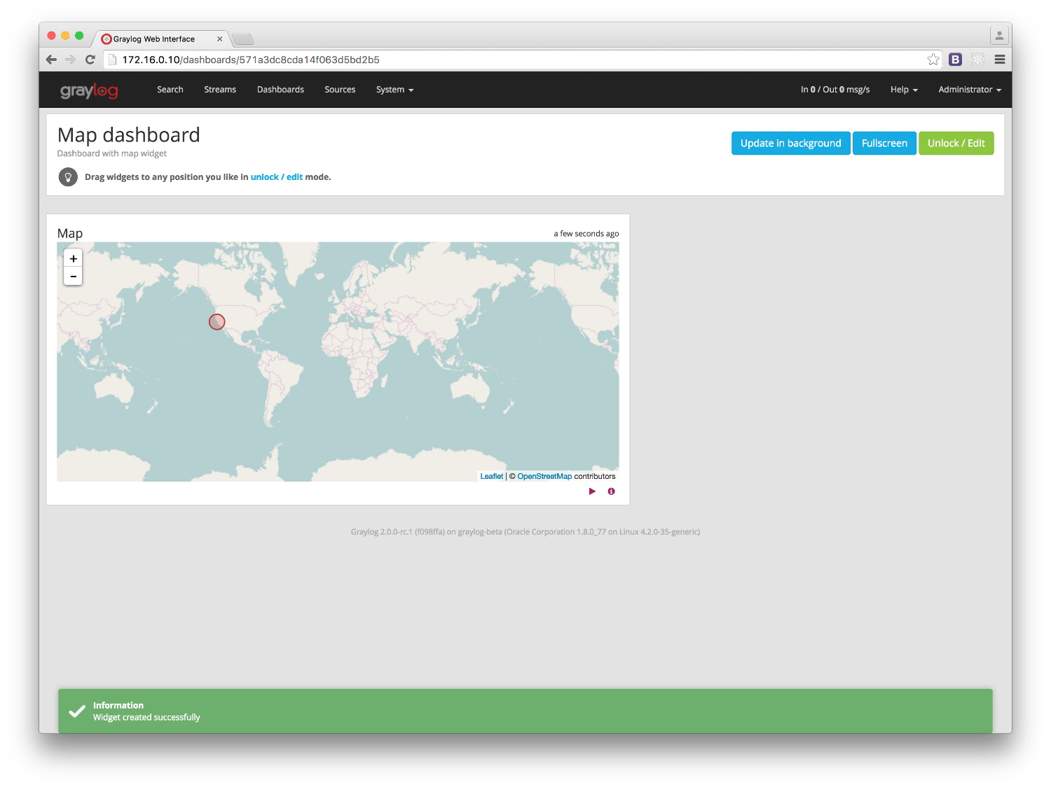
Add map to a dashboard
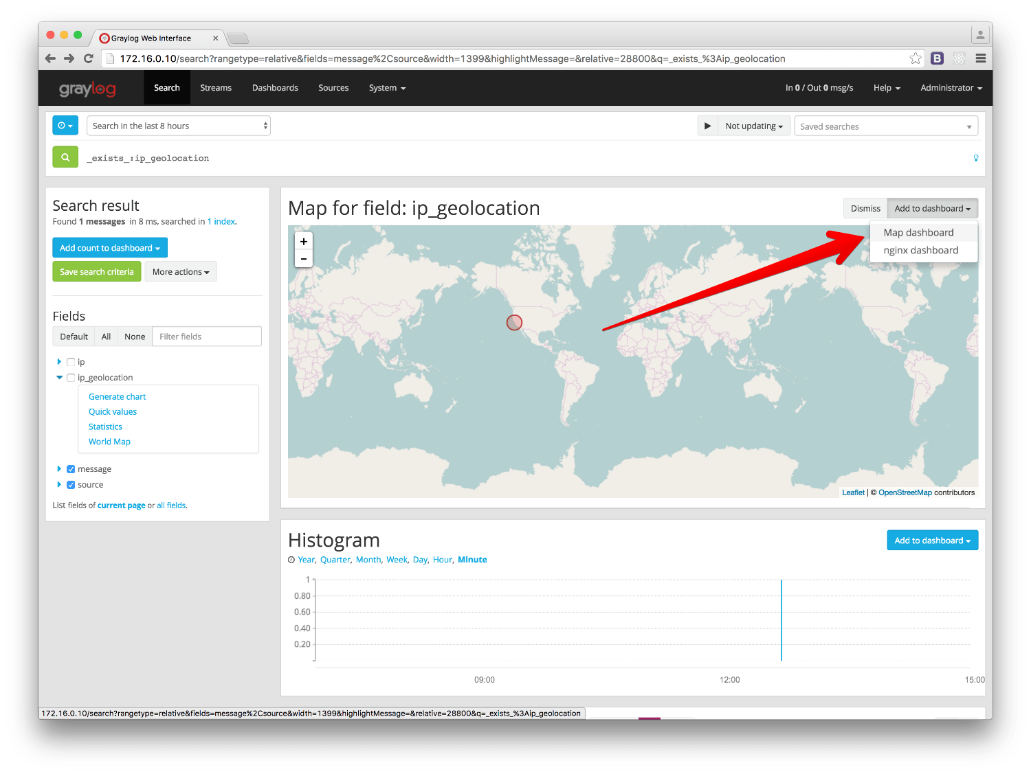
You can add the map visualization into any dashboards as you do with other widgets. Once you displayed a map in the search result page, click on Add to dashboard, and select the dashboard where you want to add the map.
FAQs
Will Graylog extract IPs from all fields?
Yes, as long as they contain exclusively an IP address.
What geo-information is extracted from IPs?
Since version 2.2.0, Graylog extracts the IP coordinates, country ISO code, and the city name if available.
Where is the extracted geo-information stored?
Extracted geo-information is stored in new message fields, named as the original field, and appended suffix
describing the stored information. That is, if the original field was called ip_address, the extracted
geo-information will be stored as follows:
ip_address_geolocationwill contain the geo-coordinatesip_address_country_codewill contain the country ISO codeip_address_city_namewill contain the city name (if available) orN/Ain other case
Which geo-points format does Graylog use to store geolocation information?
Graylog stores the geolocation information in the latitude,longitude format.
I have a field in my messages with geolocation information already, can I use it in Graylog?
Yes, as long as it contains geolocation information in the latitude,longitude format.
Not all fields containing IP addresses are resolved. Why does this happen?
Most likely it is a misconfiguration issue. Please ensure that the IPs you want to get geolocation information from are in their own fields, and also ensure that the GeoIP Resolver is enabled, and in the right order in the Message Processors Configuration, as explained in Configure the message processor.